Monday, October 24, 2022

Exploring South Seattle with Cleo - Weeks 13 to 16

 Tyler Reporting

Continuing my explorations of South Seattle, with our dog Cleo, during near-daily 2-3 mile walks.

Weeks 13 & 14

We started this pair of weeks by finishing out the Leshi quadrant, and braving the braving the I-90 floating bridge out to Mercer Island and back. Unfortunately, it ended up being our first rainy day in a long while, and hiking roughly 5 miles along a busy freeway, in the rain is about as glamorous as it sounds.
After that, we moved back South, to the Rainier Beach area. This quadrant proved to feel like the Tale of Three Cities. On the west side, you had the sleepy, suburban south end of Beacon Hill, in the center Rainier Valley with its string of immigrant (mainly East African) restuarants and businesses, then on the East edge, along Lake Washington the giant affluent houses with their gated driveways. It definitely made for an interestingwalk, when my route did go West to East.

Most of our exploring over the last two weeks has been in the Southeast corner of this image.

Not a great picture but gives you a sense of how pleasant it was crossing the I-90 floating bridge.

First time leaving Seattle proper on our walks. Just swung by a nearby park to let Cleo take care of some business... then back across the bridge.

Fun signage on the median between two curving roads. Also, note the Halloween decorations going up. Weird to think I started these walks back in June.

Construction along Rainier Avenue. I appreciated the nod to the Ethiopian flag.

Cleo... staring super-intently at yet another rabbit.

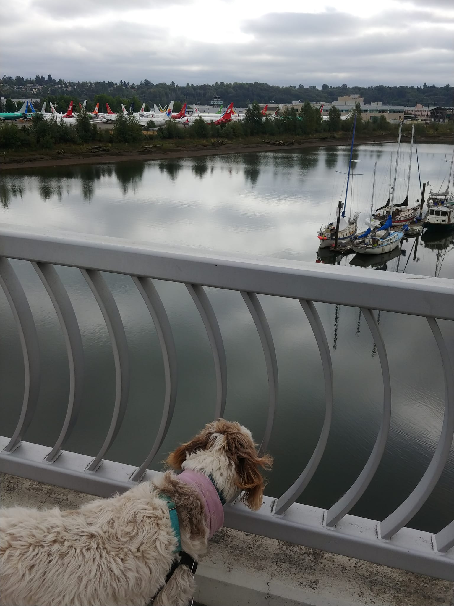
Cleo... staring super-intently at yet another cat.

Entering Rainier Beach. Running out of Southeast neighborhoods, before hitting Seattle's border with Tukwila.

I liked the little windows on this gate, made from old Donkey Kong video game screen-frames.

More Halloween decorations. I was mainly amused by the bushes.

Saw this lost dog sign on a couple of occasions, and I hope the owners found him eventually. But, also bemused by the vaguely existential tone of a sign reading "Lost Chance." Lost chance at what?!

A giant, inexplicable statue face, sitting on top of a storage container on an anonymous residential side street.

These signs went up early in the pandemic, to give people more options to go outside, during social distancing. I always wonder if anyone *really* used them but will say they make nice streets to walk down with Cleo.

Likewise, these greenways and bike routes make good dog walking routes to. Usually comparatively flat and quiet.

Weeks 15 & 16

Tyler & Cleo Explore South Seattle - Weeks 15 & 16: This two-week chunk started with us wrapping up the Southeast quadrant we'd been working on, venturing south of Rainier Beach and over to the edges of one of my favorite parks in Seattle, Kubota Gardens.
Then it was back to the Southwest, with a pair of walks explorer two remaining wedges of South Park, before jumping 509, and journeying up and down the evenly gridded streets of Highland Park, around West Crest Park and skimming White Center.
Today, we jumped to the Northwest, into the long stretches of warehouses, business parks and homeless encampments that is SoDo.

The current state of the map. All the walks for the last two weeks have been spread amongst the far SE, SW and NW corners.

Here's Beacon Ave. It amuses me up that, Beacon Ave reappears south of Beacon Hill, but here it is effectively a country lane. To the right are horse pastures. Just surreal this is Seattle.

One of my two walks in South Park this time around was through a very industrial wedge of it. All cranes, factories, shipping and business.

Another small pocket park on the Duwamish, with a traditional tribal name. There's actually an impressive number of these, but there are largely all wedged into areas with comparatively little pedestrian traffic.

Adding another twist to the more industrial part of South Park, it's also undergoing a lot of road improvement... making it quite a maze to navigate.

Homemade signs in South Park that amused me. Cleo wants to know more about these "slow cats."

While the large houses along Lake Washington could be described at mansions, that large houses of South Park are more ramshackle and almost seem to be growing organically.

Obligatory Beastie Boys mirror self-portrait.

On a quiet street in South Park, Cleo got to see her first live turkey.

The houses and streets of Highland Park are pretty generically suburban. So, I found myself taking more photos of the Halloween decorations that are cropping up.

Mysterious towers near Westcrest. Note, that's not fog, it's smoke from all the recent forest fires. I even ended up wearing a mask a couple of day, the air was so choked with smoke.

Driveway street art.

Cleo is unamused by the decorations.

I was sort of charmed by how the sidewalk goes around the tree. More of this, please.

Another selfie, only about a week after the last one. We've gone from hot and smokey to cold and rainy, like someone flipped a switch.

I'm not sure how or why the back of the sign got painted, but I thought it was kind of a cool way to activate an ignored space.

An auto shop in SoDo. I love how they've made a life-sized model car sprue.

I've avoided taking photos of the houseless encampments that dot South Seattle until now, not because I wanted to turn a blind eye to the problem, but instead because it feels icky and voyeuristically exploitative of people already in the direst of situations.

That said, as I reenter SoDo, where the situation is probably the worst, I felt that I should acknowledge that streets like this are all too common. Unfortunately, there doesn't seem to be the political will or resources to find a compassionate solution to the situation. Instead, the city seems to rely mainly on regular sweeps of camps, that seem both cruel and only push the problem around. Meanwhile, underfunded services struggle to even find places to operate in a city that suffers from extreme NIMBYism; and more and more people get pushed onto the streets through Seattle's astronomical housing prices and the current drug crisis. It's tragic on so many levels.

A view into Western Neon's showroom. Someday I just want to go in and check it out, like an art gallery.


Monday, October 10, 2022

Exploring South Seattle with Cleo - Weeks 9 to 12

 Tyler Reporting:

Continuing my explorations of South Seattle, with our dog Cleo, during near-daily 2-3 mile walks.

Weeks 9 & 10

My walks these last two weeks were wrapping up the East Quadrant, then moving on to the South Quadrant where I bump into the city limits with Tukwila, then a little bit of the West Quadrant.

These last two weeks explorations have been slowed a bit because of both a mid-week camping trip and some ongoing knee issues I'm having. Still, we managed to wrap up the Seward Park Quadrant, before moving on the new quadrant to the south, where we explored a wedge of Beacon Hill, around Boeing Field, and into South Park. We even picked up a bit of Georgetown/SoDo yesterday.
You know what area I really enjoyed? South Park. When Sarah and I first moved to South Seattle 14+ years ago, we had a running joke to the effect of "you know you are lost when you realize you are in South Park." But exploring it this week, it reminded me a lot of what appealed to me about Georgetown and Beacon Hill years ago: Diverse, working class and with a noticeable funky, artistic style. Plus, I think it's Seattle's only real community ON the Duwamish.

Sarah joined me on one section, down along the Seward Park waterfront. She's wearing her weighted vest, in preparation for her backpacking trip which would start a couple days later.

A rare self-portrait of me. Taken in the Rainier Valley.

A typical house and view in the Seward Park/Brighton Beach neighborhood.

The International District might be the official neighborhood for Seattle immigrant communities, but most of the more recent immigrants live farther south, near the Othello Station and beyond. There's a lot of shopping centers like this one that definitely aren't catering to dotcom hipsters.

A mural on a Safeway near the Othello Station.

I've got a weird obsession with Military Road. Originally built to connect Fort Steillacoom and Fort Bellingham, in the 1850s, before Washington was even a state. It pre-dates any urban planning, and the remaining sections of it always run counter to any current grid system. This section is on Beacon Hill, but I've encountered other sections farther afield.

Planes and boats. Crossing the South Park Bridge over the Duwamish. When Sarah and I first moved to South Seattle, this bridge was closed, making it feel like South Park was cut off from the rest of the city.

A pedestrian underpass beneath East Marginal Way connecting two parts of the Boeing Plant.

The Big Top Curiosity Shop, in the center of South Park. I've been eternally curious about it, but have yet to go in.

A pocket park on the Duwamish in South Park.

Another view of the Duwamish, and the Boeing Plant beyond, taken from a pier extending out over the river.

A pedestrian overpass, crossing 99.

Obligatory stairs photo. Maybe the longest stairs we've encountered, only about a third of their length is visible here, since they bend and curve out of view.

Going into SoDo, Seattle's massive unhoused population becomes more noticeable. These cement blocks are everywhere, presumably to keep people from parking their campers or setting up tents. This particular stretch has been turned into a bit of an art installation though.

Weeks 11(-ish) & 12:

The map continues to grow. Most of the growth in the southwest, but a little in the northeast.

"Week 11" ended up being spread over about 3 weeks, owing to our trip to Iceland, catching Covid and my ongoing knee issues. But we were back in the swing of things last week.
Most of the last dozen walks were exploring Seattle's SODO neighborhood, South of the West Seattle bridge. And you know what no one has ever waxed poetic about? The beauty of SODO. And for good reason. SODO is largely dominated by shipping, warehouses, long industrial strips, lined with semi rigs and tragic numbers of Seattle's unhoused population. Still, there were pockets of art and life: Murals, pocket parks and random restaurants or rogue houses left over from earlier times.
Rounding out last week, we moved on to the next "quadrant" (can you have more than four quadrants?), and we were back into the giant houses and mansions of North Mount Baker and Leshi.

A view of downtown, from SODO, looking under the West Seattle bridge. It has been closed since the start of the pandemic, but would open again a day or two later.

Cleo found her pack.

Neat (if very neglected) old hangar-style building. This is the type of place I'd point out to the kids and tell them it was where I'd open my board game cafe.

Parked rigs and shipping containers. Pretty much the order of the day in SODO. I thought the colors here at least had a Wes Anderson quality to them.

A pocket park on the edge of the Duwamish River, with its original Duwamish name.

Looking across Lake Washington. Bellevue is barely visible in the haze of forest fire smoke.

Another self-portrait of me and my walking companion.

Some of the humble houses on the North end of Mount Baker.

(At this point, I'm basically now caught up with where I am on my Facebook posts. I just posted the entry for Weeks 13 & 14 there. But I think I'll continue posting entries here in 1-month chunks. So, expect another entry here in about 2 weeks, then monthly going forward. Until I give up on this project.)